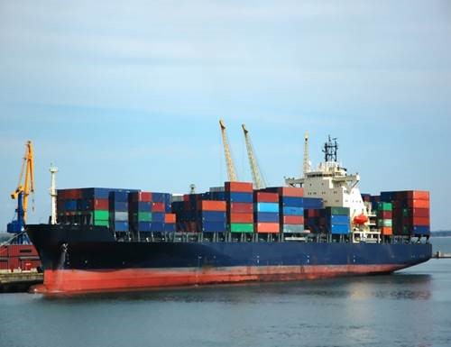
Transport through ocean shipping accounts for more than 80 percent of globally traded products. Most of the products that we use for our general use like clothes we wear, vehicles we drive, TV sets, cell phones are from different countries around the world. There are 8 major shipping routes, considered to be the busiest and handling lot of traffic around the year. The major routes are
• The English Channel
• Strait of Malacca
• Panama Canal
• Suez Canal
• Bosphorus Strait
• Strait of Hormuz
• The Danish Straits
• Saint Lawrence Seaway
The English Channel:
The channel is 350 miles long, 20-150 miles wide and 15-400 feet deep. Considered to be the busiest shipping lane in the world, separates England and France and connects the North Sea and the Atlantic Ocean. At the narrowest part of this English Channel is located the Strait of Dover. This strait connects Baltic and the North Sea. On an average of 400 ships use this strait daily.
The English Channel is called The Channel in English and La Manche in French. The English Channel is major route not only for freight traffic but also for passenger traffic too. As mentioned earlier lot of ships traverse through the Strait of Dover. With the increase in size of the ships and the speed, the sophisticated navigational safeguard systems was introduced which includes the radar tracking of the ships.
Strait of Malacca:
This waterway is connecting the Andaman Sea (Indian Ocean) and the South China Sea (Pacific Ocean). This strait is 500 miles long and funnel shaped with a width of only 40 miles in the south and broadens towards north with a width of 155 miles. The port has derived its name from the trading port of Melaka (formerly known as Malacca). The strait runs between the Indonesian island of Sumatra to the west and peninsular (west) Malaysia and extreme southern Thailand to the east with a total area of 25,000 square miles. The Strait of Malacca is the shortest sea route between India and China and hence one of the most heavily travelled shipping channel in the world.
The water depths of the strait in the south rarely exceed 120 feet and usually only about 90 feet and towards northwest, it gradually deepens up to 650 feet with the strait merging with the Andaman Basin. This strait attained its present configuration after having inundated by the postglacial rise of the sea level resulting from the melting of land ice in higher latitudes. The climatic condition of the strait is normally hot and humid and influenced by the northeast monsoon during the winter and the southwest monsoon during summer.
Panama Canal:
An artificial waterway which was completed in the year 1914, is one of the two most strategic artificial waterways in the world. The other one being Suez Canal. The canal was opened to reduce the distance traveled by the ships by about 8000 nautical miles. The canal is owned and administered by the Republic of Panama. It connects the Atlantic and Pacific Ocean through the narrow Isthmus of Panama.

The length of the canal is about 40 (65 kms) miles from shoreline to shoreline. And from deep water in the Atlantic to deep water in the Pacific of about 50 miles (82 Kms). The Panama Canal was solely controlled by the United States until 1979 from the date of opening. In 1979, the control of the canal passed to Panama Canal Commission, a joint agency of the United states and the Republic of Panama. But later the complete control passed to Panama on December 31, 1999. More than 14, 000 ships navigate the Panama Canal each year carrying vegetable oil, fats, canned and refrigerated foods, chemical and petroleum chemicals, lumber, machinery parts and grains.
Suez Canal:
The canal was opened in 1869 which is running north- south across the Isthmus of Suez in Egypt to connect Mediterranean and the Red seas. The canal provides shortest maritime route between Europe and the lands lying around Indian ocean and the Western Pacific Ocean. Being the most heavily used shipping lane in the world extends 120 miles (193 kms) between Pert Said in the north and Suez in the south. As mentioned earlier this one of the two artificial waterway in the world.
 When first it was opened the canal had a channel which was 26 feet (8 meters) deep and 72 feet (22 meters) wide at the bottom. Later, the excavation and dredging of 97 million cubic yards (74 million cubic meters) of sediments was made. More and major improvements began in the year 1876. With successful widening and deepening of the canal, the canal had a minimum width of 179 feet (55
meters).
Recent expansions allow vessels up to 66 feet in depth, 223 feet in height, 254 feet in width and 240,000 dead weight tons to pass through. The canal cannot regulate two-way traffic. Instead, ships travel in one northbound and two southbound convoys throughout a 24-hour period. There is one passing area in Ballah-Bypass near El Qantara in the Great Bitter Lake. The Suez Canal Authority of the Arab Republic of Egypt owns and operates the Suez Canal and does collect tolls. Approximately, 3.9 million oil barrels per day transited the Suez Canal in 2016; and in 2017, more than 900,000 tons of cargo travelled through. Top commodities transported are petroleum, coal, metals, wood, oil seeds, cement and fertilizers.
Bosphorus Strait:
This strait links the Black sea to the Marmara Sea which actually connects to the Atlantic Ocean. The Bosphorus is 19 miles (30 km) long and 120 – 408 feet deep with a maximum width of 2.3 miles (3.7 kms). More than 48,000 vessels navigate the Bosphorus each year, about 132 per day. Common vessels passing through include general cargo ships, bulk carriers, chemical tankers, containerships, livestock carriers, and liquid petroleum gas carriers. But, because of the strait’s width and length, there are some vessel restrictions.
 Strait of Hormuz:
The Strait of Hormuz connects the Gulf of Oman with the Persian Gulf. It consists of two lanes that accommodate inbound and outbound traffic, and a two-mile buffer zone separates them. Hormuz is
also a critical lane for oil transportation. In 2016, total oil flow increased to a record high of 18.5 million barrels per day — or, about 30 percent of the world’s total oil consumption. It’s delivered primarily to Asian markets such as China, Japan, India, South Korea and Singapore.
The Danish Straits:
The Danish Straits are a system of three channels — the Oresund, the Great Belt and the Little Belt — that interlink the North Sea and Baltic Sea. The Great Belt is the widest channel and is the primary passage for large vessels. The Danish Straits are crucial for transporting oil between Russia and Europe. In fact, an estimated 3.2 million barrels per day of crude oil and petroleum products flowed through the Danish Straits in 2016.
Saint Lawrence Seaway:
Considered the most important shipping lane in North America, the St. Lawrence Seaway connects the Atlantic Ocean with the Great Lakes. Together, the Great Lakes and St. Lawrence River form the longest deep-draft navigation system in the world. It extends 2,300 miles into North America and directly serves Ontario, Quebec, Illinois, Michigan, Ohio, Indiana, Wisconsin, New York and Pennsylvania. Every year, more than 350,000 pounds of raw materials, agricultural commodities and manufactured products travel this route. The amount of products flowing through make it a crucial network for commerce between the U.S., Canada and more than 59 overseas markets.
• The English Channel
• Strait of Malacca
• Panama Canal
• Suez Canal
• Bosphorus Strait
• Strait of Hormuz
• The Danish Straits
• Saint Lawrence Seaway
The English Channel:
The channel is 350 miles long, 20-150 miles wide and 15-400 feet deep. Considered to be the busiest shipping lane in the world, separates England and France and connects the North Sea and the Atlantic Ocean. At the narrowest part of this English Channel is located the Strait of Dover. This strait connects Baltic and the North Sea. On an average of 400 ships use this strait daily.
The English Channel is called The Channel in English and La Manche in French. The English Channel is major route not only for freight traffic but also for passenger traffic too. As mentioned earlier lot of ships traverse through the Strait of Dover. With the increase in size of the ships and the speed, the sophisticated navigational safeguard systems was introduced which includes the radar tracking of the ships.
Strait of Malacca:
This waterway is connecting the Andaman Sea (Indian Ocean) and the South China Sea (Pacific Ocean). This strait is 500 miles long and funnel shaped with a width of only 40 miles in the south and broadens towards north with a width of 155 miles. The port has derived its name from the trading port of Melaka (formerly known as Malacca). The strait runs between the Indonesian island of Sumatra to the west and peninsular (west) Malaysia and extreme southern Thailand to the east with a total area of 25,000 square miles. The Strait of Malacca is the shortest sea route between India and China and hence one of the most heavily travelled shipping channel in the world.
The water depths of the strait in the south rarely exceed 120 feet and usually only about 90 feet and towards northwest, it gradually deepens up to 650 feet with the strait merging with the Andaman Basin. This strait attained its present configuration after having inundated by the postglacial rise of the sea level resulting from the melting of land ice in higher latitudes. The climatic condition of the strait is normally hot and humid and influenced by the northeast monsoon during the winter and the southwest monsoon during summer.
Panama Canal:
An artificial waterway which was completed in the year 1914, is one of the two most strategic artificial waterways in the world. The other one being Suez Canal. The canal was opened to reduce the distance traveled by the ships by about 8000 nautical miles. The canal is owned and administered by the Republic of Panama. It connects the Atlantic and Pacific Ocean through the narrow Isthmus of Panama.

The length of the canal is about 40 (65 kms) miles from shoreline to shoreline. And from deep water in the Atlantic to deep water in the Pacific of about 50 miles (82 Kms). The Panama Canal was solely controlled by the United States until 1979 from the date of opening. In 1979, the control of the canal passed to Panama Canal Commission, a joint agency of the United states and the Republic of Panama. But later the complete control passed to Panama on December 31, 1999. More than 14, 000 ships navigate the Panama Canal each year carrying vegetable oil, fats, canned and refrigerated foods, chemical and petroleum chemicals, lumber, machinery parts and grains.
Suez Canal:
The canal was opened in 1869 which is running north- south across the Isthmus of Suez in Egypt to connect Mediterranean and the Red seas. The canal provides shortest maritime route between Europe and the lands lying around Indian ocean and the Western Pacific Ocean. Being the most heavily used shipping lane in the world extends 120 miles (193 kms) between Pert Said in the north and Suez in the south. As mentioned earlier this one of the two artificial waterway in the world.
 When first it was opened the canal had a channel which was 26 feet (8 meters) deep and 72 feet (22 meters) wide at the bottom. Later, the excavation and dredging of 97 million cubic yards (74 million cubic meters) of sediments was made. More and major improvements began in the year 1876. With successful widening and deepening of the canal, the canal had a minimum width of 179 feet (55
 meters).
Recent expansions allow vessels up to 66 feet in depth, 223 feet in height, 254 feet in width and 240,000 dead weight tons to pass through. The canal cannot regulate two-way traffic. Instead, ships travel in one northbound and two southbound convoys throughout a 24-hour period. There is one passing area in Ballah-Bypass near El Qantara in the Great Bitter Lake. The Suez Canal Authority of the Arab Republic of Egypt owns and operates the Suez Canal and does collect tolls. Approximately, 3.9 million oil barrels per day transited the Suez Canal in 2016; and in 2017, more than 900,000 tons of cargo travelled through. Top commodities transported are petroleum, coal, metals, wood, oil seeds, cement and fertilizers.
Bosphorus Strait:
This strait links the Black sea to the Marmara Sea which actually connects to the Atlantic Ocean. The Bosphorus is 19 miles (30 km) long and 120 – 408 feet deep with a maximum width of 2.3 miles (3.7 kms). More than 48,000 vessels navigate the Bosphorus each year, about 132 per day. Common vessels passing through include general cargo ships, bulk carriers, chemical tankers, containerships, livestock carriers, and liquid petroleum gas carriers. But, because of the strait’s width and length, there are some vessel restrictions.
 Strait of Hormuz:
The Strait of Hormuz connects the Gulf of Oman with the Persian Gulf. It consists of two lanes that accommodate inbound and outbound traffic, and a two-mile buffer zone separates them. Hormuz is
also a critical lane for oil transportation. In 2016, total oil flow increased to a record high of 18.5 million barrels per day — or, about 30 percent of the world’s total oil consumption. It’s delivered primarily to Asian markets such as China, Japan, India, South Korea and Singapore.
The Danish Straits:
The Danish Straits are a system of three channels — the Oresund, the Great Belt and the Little Belt — that interlink the North Sea and Baltic Sea. The Great Belt is the widest channel and is the primary passage for large vessels. The Danish Straits are crucial for transporting oil between Russia and Europe. In fact, an estimated 3.2 million barrels per day of crude oil and petroleum products flowed through the Danish Straits in 2016.
Saint Lawrence Seaway:
Considered the most important shipping lane in North America, the St. Lawrence Seaway connects the Atlantic Ocean with the Great Lakes. Together, the Great Lakes and St. Lawrence River form the longest deep-draft navigation system in the world. It extends 2,300 miles into North America and directly serves Ontario, Quebec, Illinois, Michigan, Ohio, Indiana, Wisconsin, New York and Pennsylvania. Every year, more than 350,000 pounds of raw materials, agricultural commodities and manufactured products travel this route. The amount of products flowing through make it a crucial network for commerce between the U.S., Canada and more than 59 overseas markets.